Remote sensing provides information about objects at or near the surface of the Earth and atmosphere based on radiation reflected or emitted from those objects. The information is usually captured at a distance from the above in the form of image data. Such data allow us to determine the composition and nature of the Earth’s surface and atmosphere from local to global scales and assess changes by analyzing images captured at different points in time.
An example of a recent study conducted by the University of Turku:
Tua Nylén, Mikel Calle & Carlos Gonzales-Inca (2025):
Unveiling coastal change across the Arctic with full Landsat collections and data fusion
Remote Sensing of Environment 2025, Volume 322
https://doi.org/10.1016/j.rse.2025.114696.
Licensed under Creative Commons Attribution 4.0 International (CC BY 4.0).
 © Nylén et al. 2025, Remote Sensing of Environment, CC BY 4.0.
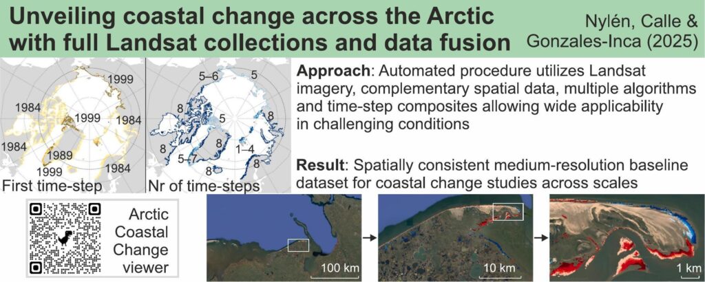
“Arctic communities urgently need regional to local-scale information on the rapid coastal changes, caused by thawing permafrost, melting glaciers, and declining sea ice. We introduce a procedure for mapping coastal land cover change from satellite images in the challenging Arctic conditions (and beyond). Our approach utilizes data fusion and cloud computing in Google Earth Engine to process the full Landsat collections for the entire Arctic. It merges information from multiple Landsat sensors and utilizes complementary spatial data and two algorithms to enhance classification accuracy and processing efficiency. This mitigates issues with local illumination conditions and the low availability and quality of satellite data in the Arctic before 2010s. Calculating post-classification composites of coastal land cover over five-year time-steps effectively reduces the impacts of clouds, suspended sediment, and the tide. The procedure was iteratively developed in calibration sites with contrasting physical characteristics. Validation of the final product indicates an overall classification accuracy of more than 98% (against manually labelled data) and a median shoreline error distance of c. 20 and 10 m in mesotidal and microtidal coasts, respectively. The resulting Arctic Coastal Change dataset presents coastal dynamics from 1984 to 2023 at a 30-m resolution, and highlights hotspots that experience coastal erosion or accretion at a rate of more than 10 m/a. The overall coherence of our results with 61 other studies across the Arctic shows the robustness of the procedure. However, exploring the dataset may uncover localized errors that call for procedure improvements through new collaborative Arctic coastal dynamics studies.”
© Nylén et al. 2025, Remote Sensing of Environment, CC BY 4.0.
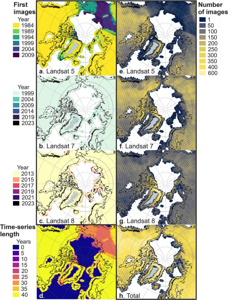
Landsat data availability in the Arctic.